History is easy to imagine as a timeline filled with famous empires, powerful rulers, and dramatic battles.
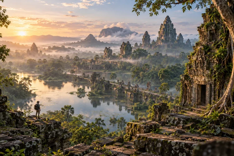
But travel across Asia and a different version of the past begins to appear in ruined temples, abandoned capitals, old reservoirs, defensive walls, and roads disappearing into forests.
These forgotten kingdoms across Asia were not necessarily small or unimportant. Some controlled extensive trade networks, built sophisticated cities, supported powerful religious institutions, and influenced cultures far beyond their borders.
Yet changing trade routes, warfare, environmental pressures, political decline, and the rise of new states eventually pushed many of them out of everyday memory.
Their landscapes remain.
From Myanmar’s ancient Pyu cities and the temple plains of Bagan to Cambodia’s Angkor, Vietnam’s Champa sanctuaries, and Thailand’s Sukhothai, archaeology allows travelers to read history directly from the terrain.
Exploring these places is not simply about seeing ruins. It is about understanding how geography, religion, agriculture, trade, and political ambition shaped civilizations that once seemed permanent.
Ancient Landscapes Tell Stories That Written Records Cannot
Historical documents usually focus on kings, wars, taxation, diplomacy, and religion. Landscapes reveal another part of the story.
An abandoned reservoir can show how a kingdom managed water. A city wall reveals concerns about defense. Temple locations may explain religious geography, while roads and river ports reveal where people and merchandise once moved.
This becomes especially important when written evidence is limited.
Many early Asian states left behind inscriptions, religious texts, or foreign accounts rather than complete political histories. Archaeologists therefore reconstruct their development by combining architecture, artifacts, inscriptions, environmental evidence, and settlement patterns.
When viewed this way, ruins stop being isolated monuments. They become fragments of an entire social system.
A temple only makes complete sense when you also notice the farmland, waterways, settlements, roads, and political territory surrounding it.
The Pyu Cities Reveal an Early Urban Civilization in Myanmar
Long before Bagan became famous, the Pyu developed major urban settlements in what is now Myanmar.
The ancient cities of Halin, Beikthano, and Sri Ksetra flourished between roughly 200 BCE and 900 CE. Their remains include brick walls, moats, Buddhist monuments, burial areas, manufacturing sites, and sophisticated water-management systems.
What makes the Pyu landscape particularly interesting is the connection between cities and agriculture.
These communities lived in a relatively dry region, so controlling seasonal water was essential. Canals, tanks, and irrigation infrastructure supported agricultural production, and some elements of that landscape continue influencing farming today.
The Pyu also demonstrate how cultural exchange worked in early Southeast Asia. Indic religious and literary traditions arrived from South Asia, but local communities did not simply copy them. They adapted these influences and developed distinct urban and Buddhist traditions.
Their cities remind us that cultural exchange rarely creates perfect replicas. It creates something new.
Bagan Shows How Religion Could Shape an Entire Capital
Travel forward several centuries and the landscape changes dramatically.
Bagan, located beside the Ayeyarwady River, became the centre of a powerful regional kingdom between the 11th and 13th centuries. Today its plains contain an extraordinary concentration of temples, stupas, monasteries, archaeological remains, sculpture, and religious art.
The monuments were not simply decorative displays of wealth.
Religious donations were closely connected with political authority and Buddhist merit-making. Kings, elites, and ordinary patrons supported religious construction, helping transform the area into a vast sacred landscape.
That relationship is visible when exploring Bagan today.
Individual monuments are impressive, but the wider plain tells a more interesting story. Temples appear in clusters, old settlements sit among agricultural land, and the river explains why this location became strategically valuable.
Bagan shows how political power can literally reshape an enviroment.
Angkor Was Much More Than Angkor Wat
Few historic landscapes in Asia demonstrate political ambition as clearly as Angkor.
Many travelers naturally focus on Angkor Wat, but the wider archaeological landscape covers roughly 400 square kilometres and contains temples, ancient urban plans, roads, reservoirs, dykes, canals, and other hydraulic structures associated with successive capitals of the Khmer Empire.
That scale changes the way Angkor should be understood.
This was not simply a collection of religious monuments surrounded by jungle. It was a sophisticated urban and agricultural landscape in which water management played a major role.
Large reservoirs, commonly called barays, and extensive canal systems helped organize water across the region. The placement of temples and cities also reflected political hierarchy and religious symbolism.
Walking through Angkor therefore means exploring the remains of an entire civilization, not just photographing spectacular ruins.
Its architecural achievements are impressive, but its engineered landscape may tell an even bigger story.
My Son Preserves the Spiritual World of the Champa Kingdom
In central Vietnam, the ruins of My Son reveal a very different historic society.
The sanctuary developed between the 4th and 13th centuries and became an important religious and political centre of the Champa Kingdom. Its tower temples reflect strong connections with Hindu traditions originating in India.
Champa occupied parts of the coast of what is now central and southern Vietnam, where maritime trade played an important role.
That coastal orientation helped connect Champa with wider commercial and cultural networks linking South Asia, Southeast Asia, and China.
At My Son, those connections became visible through religion and architecture.
Yet the site is not simply “Indian culture in Vietnam.” Cham builders developed their own artistic traditions, construction methods, religious expressions, and architectural forms.
The surrounding mountains also contributed to the sacred character of the sanctuary.
It is another reminder that geography could be spiritual as well as strategic.
Sukhothai Reveals How Kingdoms Were Built as Networks
Historic capitals can sometimes create the illusion that political power was concentrated in one city. Sukhothai shows why the wider regional network matters.
The World Heritage property includes Sukhothai, Si Satchanalai, and Kamphaeng Phet, three closely connected historic towns associated with the early Kingdom of Siam.
Sukhothai served as a major political and administrative centre, while Si Satchanalai had important religious functions and became a significant ceramic-production centre. Kamphaeng Phet occupied a strategic southern frontier and helped protect regional trade.
The three settlements were connected by roads and shared systems for managing water.
That makes the landscape unusually useful for understanding how medieval kingdoms actually functioned.
Political capitals needed religious centres, manufacturing zones, agricultural resources, defensive positions, and transportation links. A successful kingdom was therefore less like a single city and more like an interconnected system.
Following those relationships reveals much more than visiting one famous temple.
Borobudur Reveals the Power of the Syailendra Dynasty
Central Java offers another historic landscape where architecture, religion, and political authority came together.
Borobudur was constructed during the 8th and 9th centuries under the Syailendra Dynasty. The monument consists of multiple terraces, circular platforms, hundreds of Buddhist sculptures, extensive reliefs, and a monumental central stupa.
But Borobudur becomes even more interesting when viewed as part of its wider landscape.
The complex includes Borobudur, Mendut, and Pawon, three monuments positioned along an approximate axis. UNESCO describes Borobudur as an important dynastic monument associated with Syailendra rule in Java.
Its architecture also demonstrates the blending of Buddhist cosmology with local traditions.
That combination challenges simple ideas about cultural influence. Religious concepts could travel enormous distances, but once they arrived, local societies reinterpreted them according to their own artistic traditions and political needs.
In that sense, historic monuments are not merely evidence of outside influence. They are evidence of local creativity.
Why Powerful Kingdoms Eventually Disappear
Standing among monumental ruins raises an obvious question: how could something this powerful disappear?
There is rarely one simple answer.
Political systems can weaken through internal conflict, changing alliances, military pressure, economic disruption, or succession problems.
Trade routes may shift toward different ports and commercial centres. Environmental stress can also affect agriculture and water systems.
Sometimes the capital moves while the population remains. In other cases, religious or political priorities change and once-important monuments gradually lose their original function.
This is why calling these societies “lost” can be misleading.
Their political institutions may have disappeared, but their cultural influence often survived in languages, artistic traditions, religious practices, agricultural systems, and later kingdoms.
The ruins are only the most visible remains.
How to Read a Historic Landscape When Traveling
Exploring ancient sites becomes far more rewarding when you look beyond the headline monument.
Notice where the settlement sits in relation to rivers, mountains, coastlines, and agricultural land. Ask where food and water came from, how travelers entered the city, and which areas were protected by walls.
Also pay attention to what survives outside the main archaeological zone.
Old roads, smaller shrines, canals, ceramics, settlement mounds, and village traditions may reveal connections that are easy to miss when rushing between major attractions.
Maps are especially useful.
Comparing the ancient layout with the modern landscape can show how a kingdom organized sacred areas, commercial districts, transportation, agriculture, and political centres.
Suddenly the ruins are no longer seperate buildings. They become pieces of one enormous historical puzzle.
Discovering forgotten kingdoms across Asia means looking beyond famous rulers and monumental temples.
The most revealing evidence often lies in the landscapes surrounding them: irrigation systems, roads, rivers, workshops, defensive walls, farmland, and sacred geography.
The Pyu cities, Bagan, Angkor, My Son, Sukhothai, and Borobudur each show different ways that Asian civilizations combined political power with religion, trade, engineering, and cultural exchange.
Their kingdoms eventually changed or disappeared, but their influence did not simply vanish.
When visiting an ancient Asian site, explore beyond the main landmark. Study the terrain, follow older routes, notice the water systems, and consider why people chose that particular place.
The landscape itself may tell you more about a lost kingdom than any surviving palace ever could.